
Scaling Sheer Cliff Faces and 80-Year-Old Cables on Picacho Peak

Climbing one of the steepest pitches. Photo: Christine Henry
"If this trail were in Zion National Park, people would be dying left and right," I quipped to my fiancée Christine. We had just finished scaling one of many challenging stretches of the steep climb to the top of Picacho Peak, a monolith that towers above Interstate 10 in Southern Arizona.
From the bottom, Picacho Peak doesn't look like that intimidating of a mountain. Sure, it has some dramatic rock sides, but it's really not all that tall. Rising to a height of 3,374 feet above sea level, the peak is just 1,374 vertical feet above the rest of the state park in the flat desert below.
But exactly how much vertical gain is required to climb the mountain is tricky to determine.
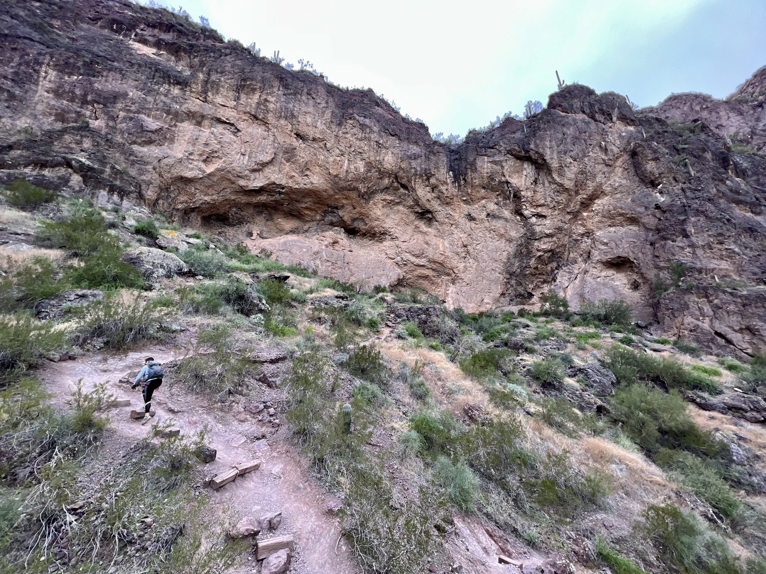
The initial approach to the saddle.
The trail begins by ascending via a series of steep, rocky switchbacks before gaining a saddle. Many neophyte hikers think the saddle is the destination, but that steep climb is only the beginning. From here, the trail gets dramatically more technical and much steeper, and it descends back down the opposite side of the mountain before turning around and making for the summit. Since the terrain is nearly-vertical, the cliff faces play havoc on GPS devices and maps.
SoCalHiker.net lists the elevation gain for this hike as 1,986 feet, although to me, that seems like it might be the one-way elevation gain. Round-trip, this hike still probably gains more. Regardless, this short ~3-mile hike is a steep, technical affair.
But it's not just the elevation gain that makes this hike so challenging: it's the technicality of the climb. After passing the saddle, the website for Picacho Peak State Park notes that "the route becomes difficult, steep and twisting, with steel cables (gloves are recommended) anchored into the rock in places where the surface is bare."
This statement is accurate, but it belies the truly rugged nature of this steep climb.
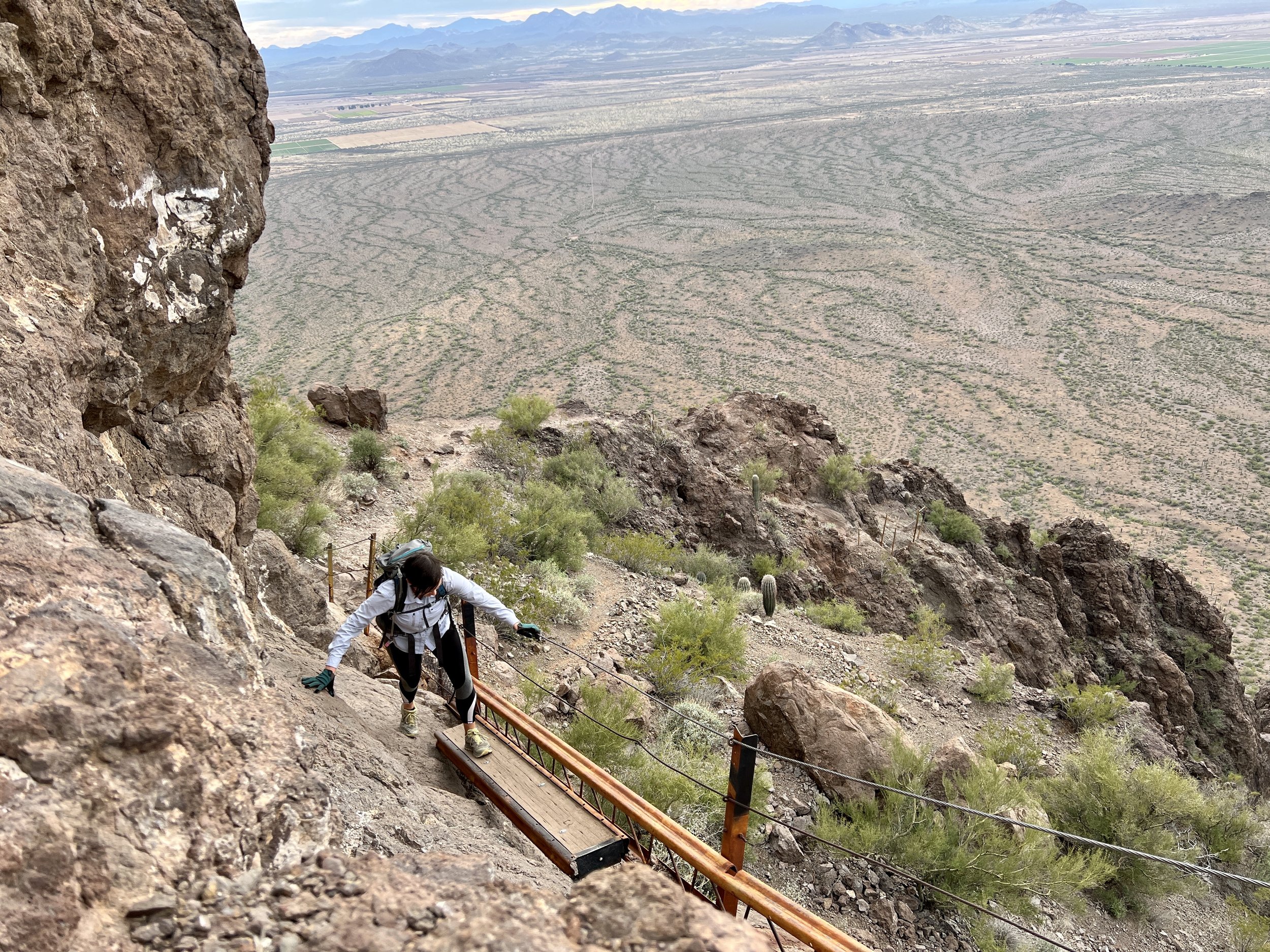
From the saddle, we pulled on our gloves as we slid down a slick slab of rock and rock ledges, holding onto cables as we descended. After bottoming out, the climb begins again in earnest.
We scaled vertical rock faces with fifth-class moves that were protected by said "cables anchored in rock..." if by "anchored," you mean thin wires connected by wiggling, creaking brackets drilled into the rock face with woefully-small bolts. In places, chicken wire fencing strung along the top of a sheer cliff face was the only form of protection.
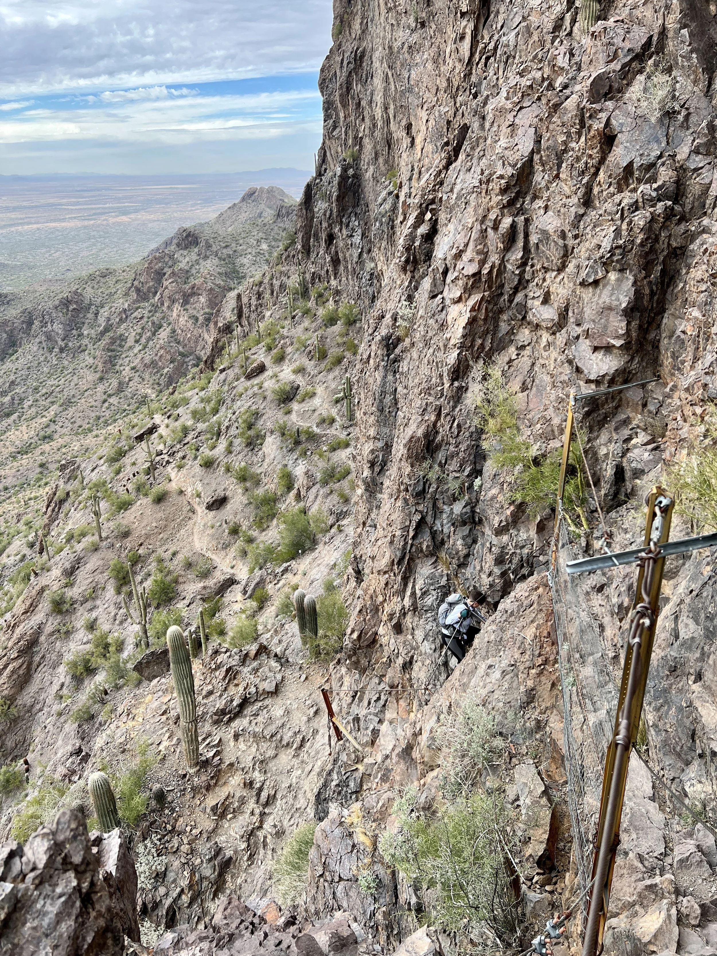
Climbing one of the steepest pitches.
While some sections of the cables and fencing have been reinforced in recent years, most of the protection was originally erected in 1932 so that maintenance workers could reach a light beacon on the summit. It's highly unlikely that the original Civilian Conservation Corps trail builders thought that the metal cables they were erecting would still be in service over 80 years later... but here we are, putting our lives on the line with thin metal bands as our sole protection.
We rounded a few tight corners and scaled a few sections of vertical cliff face, with some of the most dramatic exposure of the day. While the small cables were a nice afterthought and aided in the downclimb, on the ascent, committing to the rock holds was by far the most reliable means of upward motion. Since we were scaling the cliffs without ropes or harnesses, we took turns on each section of scrambling, in case one of us were to lose our grip and fall. The cliffs were too tall and gnarled and the landings too small to spot the other person effectively. Following too closely and having the first climber fall could potentially knock both climbers off the wall, killing two people instead of one. We each individually had to accept total responsibility for our safety while climbing.
As I scaled a section and stopped on a landing to wait for Christine to clear it, her smile was wide, and her eyes danced with happiness. "This is absolutely incredible—I can't believe we're getting to do this today!" she said. "Guess it's just another normal Tuesday afternoon?!"

Beautiful boardwalk section.
Shortly after, a suspended boardwalk across a small chasm provided one of the most visually-stunning stretches of the hike, and soon, we topped out on the summit of Picacho Peak.
"This was, by far, the sketchiest climb I've done without a harness on in years," I commented as we soaked in the 360-degree views from the peak. The desert spread out below us, with the flat basins punctuated by rugged mountain ranges in the distance. From the top, we could spot our campsite in the state park and the easier trails winding around the base of the mountain.
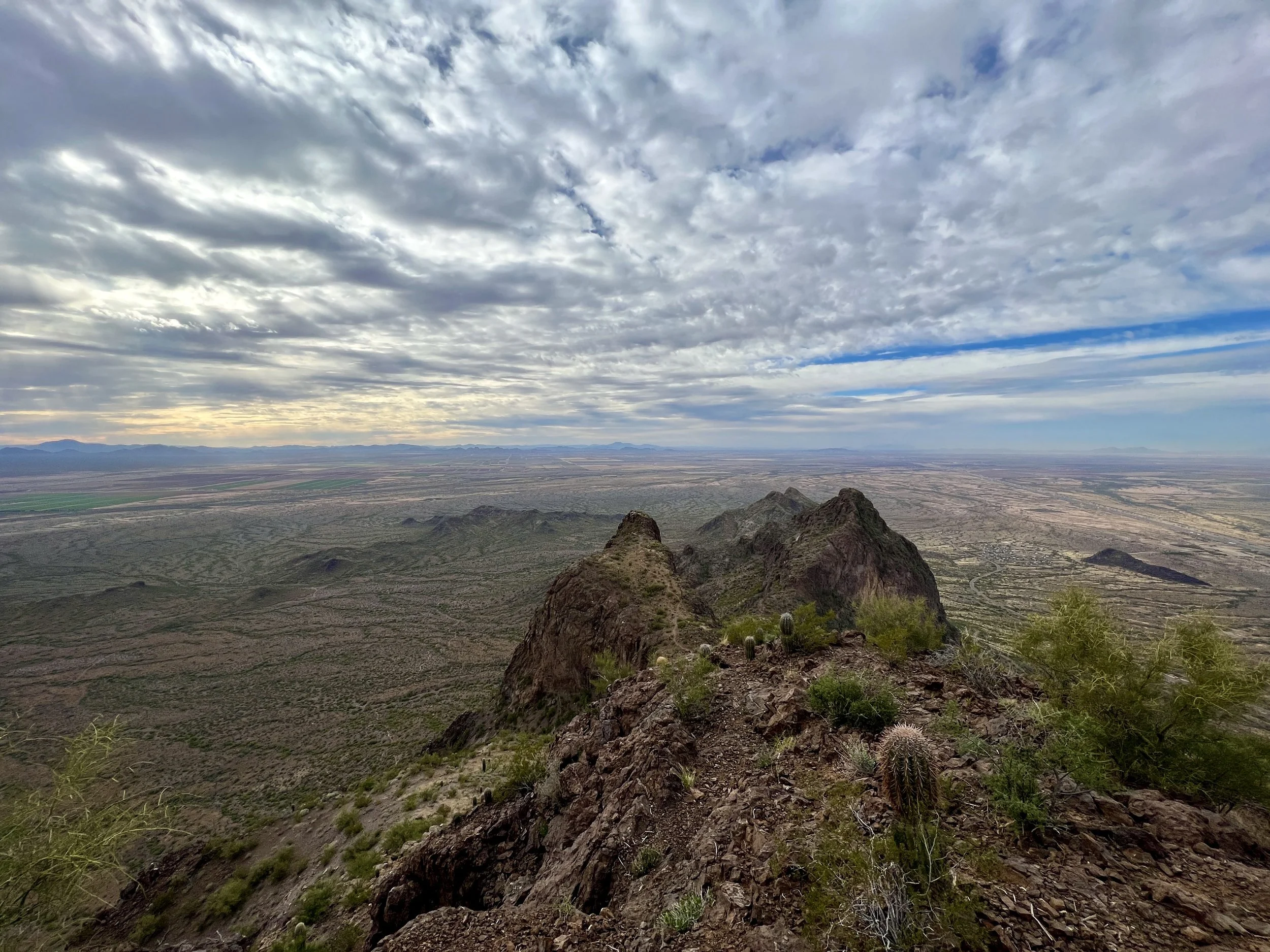
View from the top of Picacho Peak
While some of the vertical rock faces and dramatic fall exposure did give us pause, we found the climb exhilarating! But other people? Not so much. Most hikers get turned around at the saddle, and others—even if they make it to the summit—hate the experience and vow never to return. Lila Menconi dubbed the experience "Hell Hike" in an article published on her blog, the Phoenix New Times.
Despite claiming to be "an experienced hiker," Menconi says that on the hike up Picacho Peak, "I cried. Four times."
Deaths on Picacho Peak VS Angel's Landing
Boardwalk section on Picacho Peak.
Yet, she made it. After descending off the mountain, I found myself wondering how many people had fallen to their deaths from the elevated cliff faces.
A quick Google search revealed this article, which claims that there have been four deaths on Picacho Peak in recent history... but all of them were caused by dehydration and overheating. The most recent fatality was the tragic death of "a 16-year-old Boy Scout who collapsed on a troop hiking trip" in 2019, according to Tucson.com.
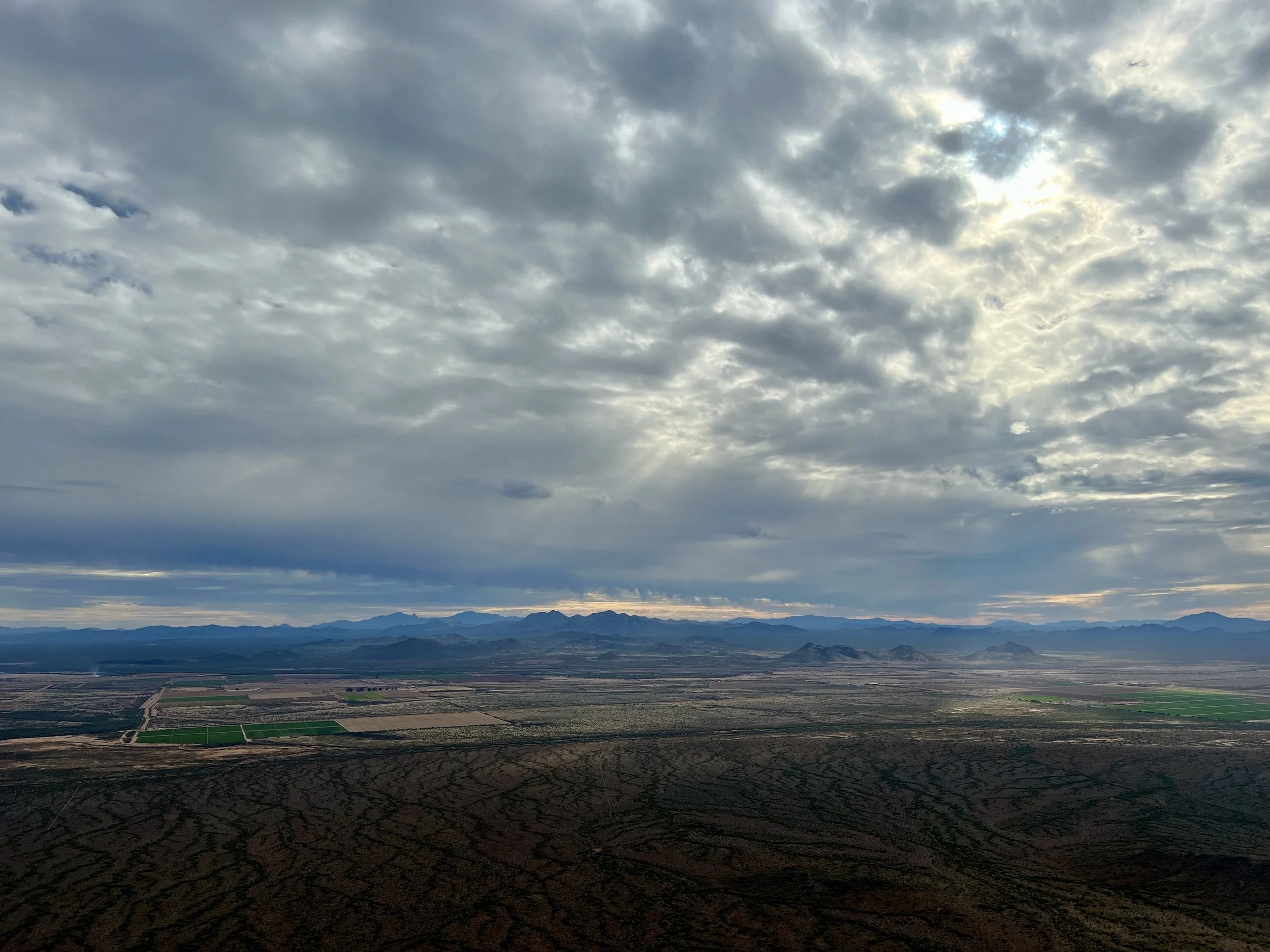
View from the top of Picacho Peak on a cloudy January day.
Despite the publish date on this article, we actually completed our climb on an overcast day in January. Even in January, this treeless, exposed pillar of rock rising tall in the Sonoran Desert was quite warm. I can't imagine climbing it during the heat of the summer. Many signs at the trailhead try to warn hikers away during the heat of summer, but still: signs are only a marginally effective deterrent.
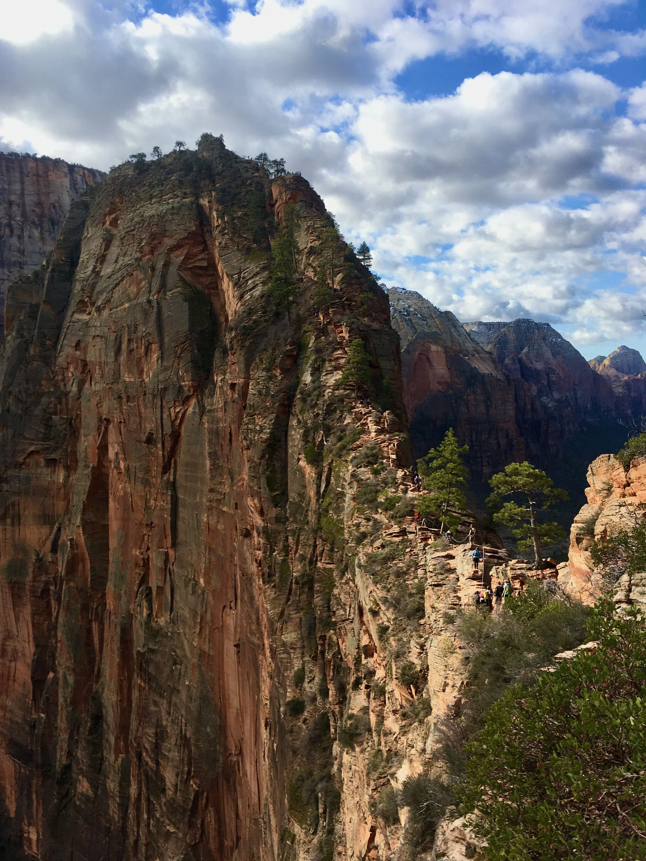
Profile view of Angel’s Landing
The comparison to Angel's Landing sprung to my mind, as it's often touted as "the deadliest hike in the world," or some other absurd hyperbole. The shape of the mountain and the exposure of the climb on Picacho Peak are also reminiscent of the ultra-famous ascent to the top of Angel's Landing. Yet after having done both myself, there's no comparison: Picacho Peak is way, way sketchier.
But sheer sketchiness doesn't have much to do with causing deaths. Rather, the unpreparedness of the hikers attempting the climb is the biggest contributing factor.
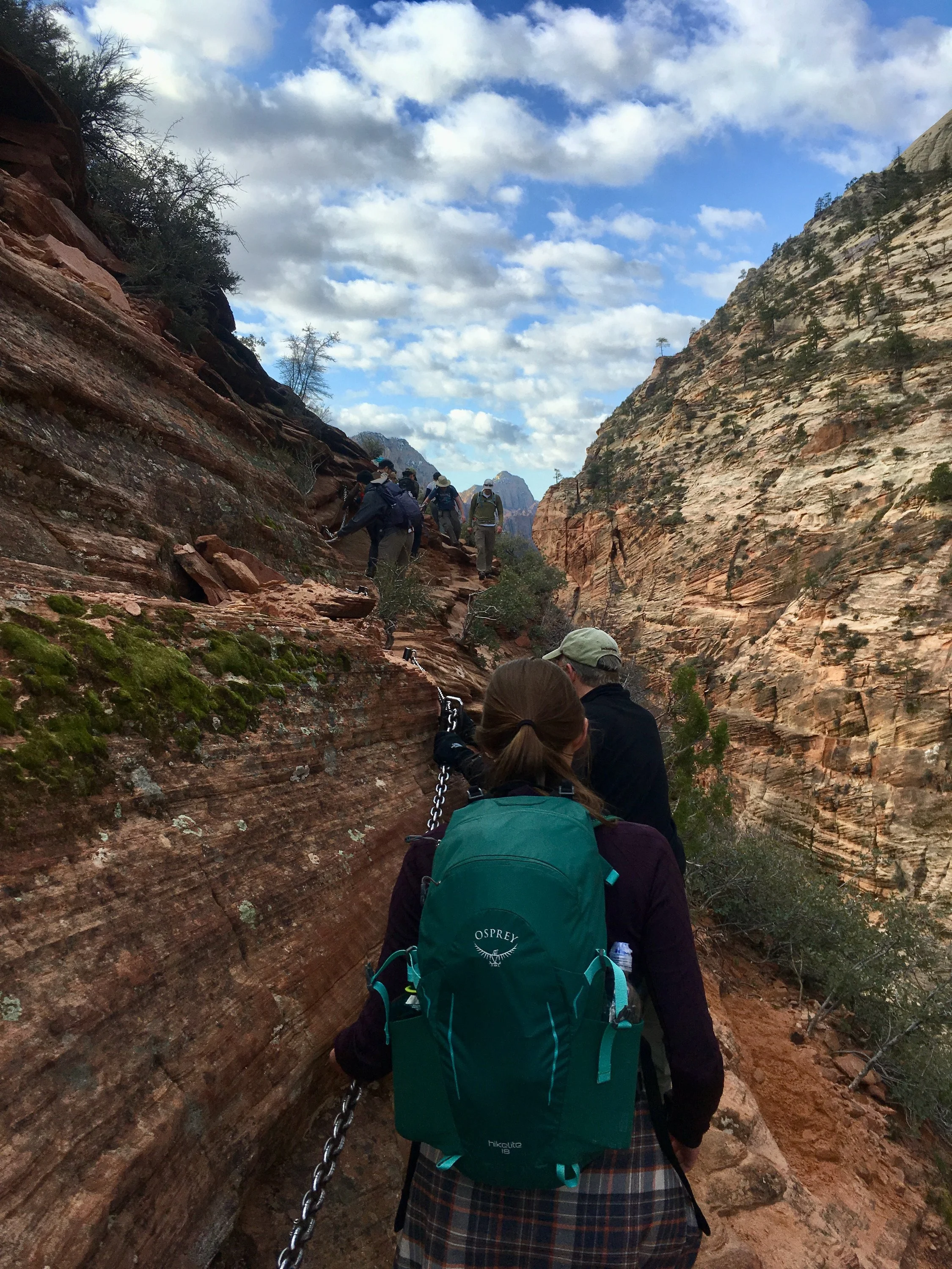
Crowds on the chains at Angel’s Landing.
According to an article on Advnture.com, a total of 14 people have died while hiking Angel's Landing in the past 20 years. Other articles list between 17 and 20 deaths over time. And unlike Picacho Peak, most of these deaths were due to falls.
However, as the Advnture article outlines, this number of fatalities is largely due to sheer probability at work. Before the implementation of the permit system in 2022, over 300,000 people per year were hiking Angel's Landing, according to The Salt Lake Tribune. While no numbers are readily available for a clean comparison with Picacho Peak, the number of hikers attempting this summit is a tiny fraction of those heading for Angel's Landing. And remember: your chances of dying are still radically higher while driving to the trailhead than while actually climbing Angel's Landing or Picacho Peak.
But put 300,000 inexperienced hikers per year on Picacho Peak? That would be a recipe for disaster.
Consider yourself warned. Or perhaps invited? It's all a matter of perspective.