
Hike Sedona's Twin Buttes Loop for an Immersive 360-Degree Red Rock Experience
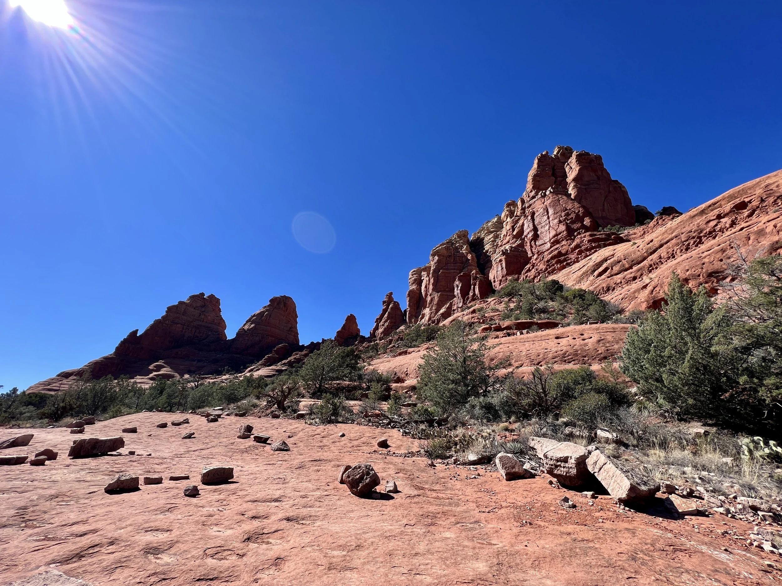
Bright sun and red rocks on the Twin Buttes Loop.
Over the past few decades, Sedona has transformed from a quiet hippy town into a trendy tourist destination. The reason is clear: the red rock views from "downtown" Sedona are some of the most incredible, most spectacularly-beautiful vistas from any downtown location in North America. As you sit on one of the many outdoor patios enjoying overpriced cocktails and mediocre food, you can stare up at the towering red rock cliffs that soar into the sky all around you. As you inevitably move from one drink to the next, the perspective of the various rock formations changes, and picking out which rock formations or mountain peaks you're looking at can be an entertaining exercise (one made much easier by FATMAP's 3D map).
Driving through the narrow, twisty roads that wind up and down the parallel canyons is often a stop-and-go affair, with lines of honking cars backed up for many miles on the weekends. Tourist destinations like the Chapel and Chicken Point (with the Pink Jeeps delivering their loads of slack-jawed gapers) crawl with humans every day of the week. And the lines don't get much better on the trails: popular vistas like Devil's Bridge are inundated with tourists and influencers standing in line in the hopes of getting their own particular selfies on top of the beautiful rock formation.
While all of Sedona's trails are popular and crowded with tourists, if you put in a little work, you can still find fantastic hikes that reach some of Sedona's most spectacular locations while providing an overwhelming experience of beauty and nature along the way. A recent loop hike that I put together in Sedona circumnavigating the Twin Buttes provided just such an experience.
Hiking the Twin Buttes Loop
Isolated and free of tourists, the Twin Buttes Loop is not. In fact, it passes two of the aforementioned destinations: the Chapel and Chicken Point. However, if you hike this circuit, you get to visit both of these beautiful spots on your own terms—without being packed into a Pink Jeep or vying for a parking spot at the Chapel.
You will have to arrive early to score a parking spot, though: the hike as mapped begins on the Mystic trail off of Chapel Road. This trailhead is simply a narrow dirt pull out along the road, which means that it can easily fill up, even on weekdays. But if you arrive early enough to score a parking spot, you're golden! You could also begin this hike from the Chapel itself if there's a parking spot to be had there. If you're game for some bonus miles, the Broken Arrow trailhead on the opposite side of the mountain also provides access to this network.
Even though this 3.8-mile hike crosses a low mountain pass, it is still quite aerobically moderate. This entire loop only gains 509 feet of vertical, meaning that many prospective hikers will be able to complete this hike.
The hiking starts off easy, rolling up and down on the mostly-smooth Mystic trail. As you begin to turn right around the edge of the butte, you'll climb a bit to gain a rough, rocky bench-cut trail that traverses the north side of the buttes.
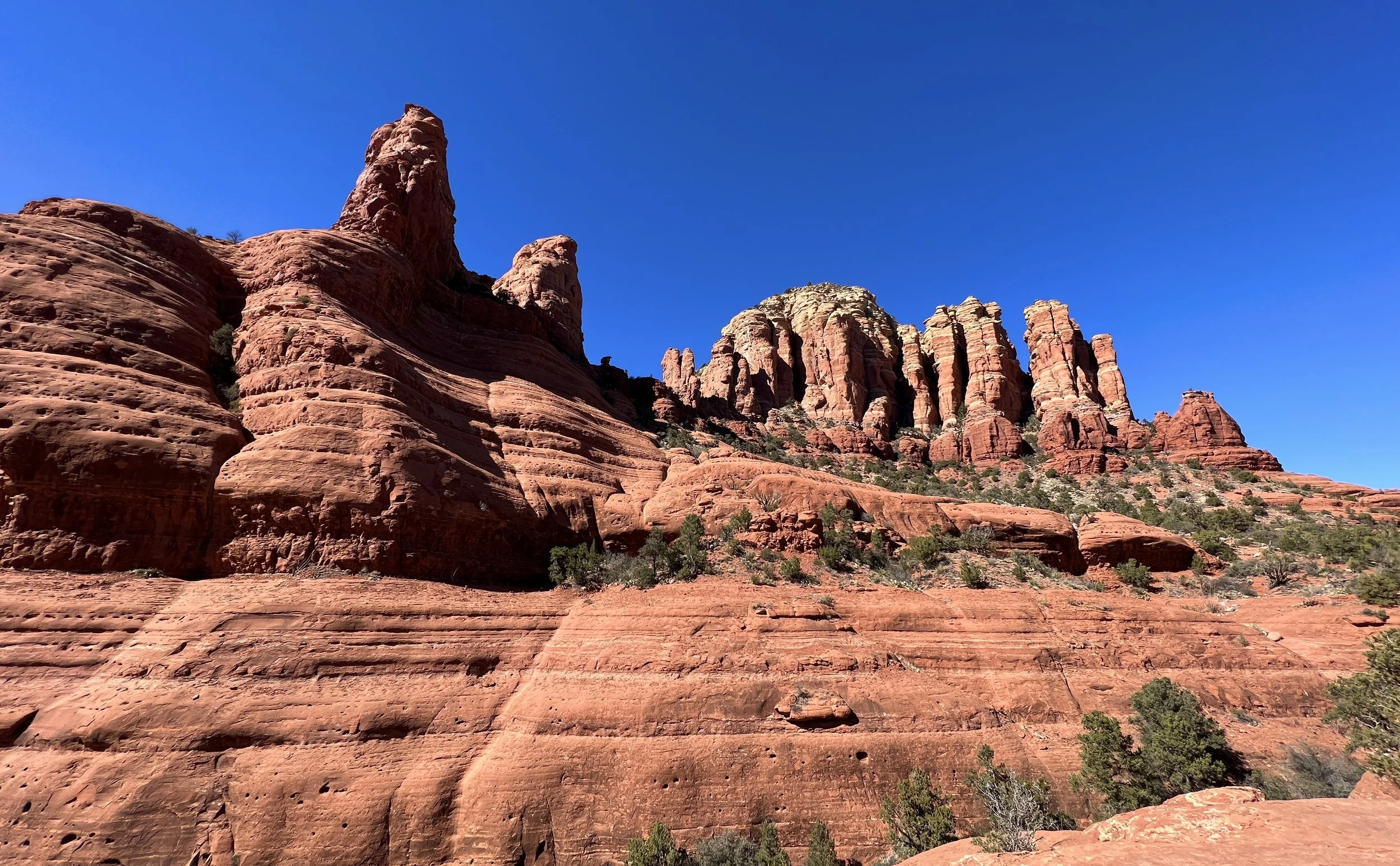
While you could theoretically hike this loop in either direction, the clockwise direction marked here is highly recommended. As you begin traversing the north side of the ridge, you'll see why: this area is very popular with mountain bikers, and several of the trails on this side of the mountain are designated for one-way mountain bike traffic. When hiking the loop in this direction, you'll be hiking *against* the mountain bike traffic, so you can see the riders coming toward you. This is very important as these trails, known collectively as "The Hogs," are some of Sedona's famed double black diamond mountain bike descents. While hiking up the exposed slabs of bedrock, you'll inevitably get to watch riders try their luck on the steep, slippery, dangerous rock features that Sedona is famous for.
Seeing the bikers coming toward you on this section is doubly important, as The Hogs are one of the areas in Sedona where the trail signs note that both hikers and bikers should yield to each other equally. While on most multi-use trails in the national forest, mountain bikers are supposed to yield to hikers, on some of the steep rock slabs found on The Hogs, it is impossible for bikes to stop—and the trail signs acknowledge this. So hikers should be very aware of what's going on around them.
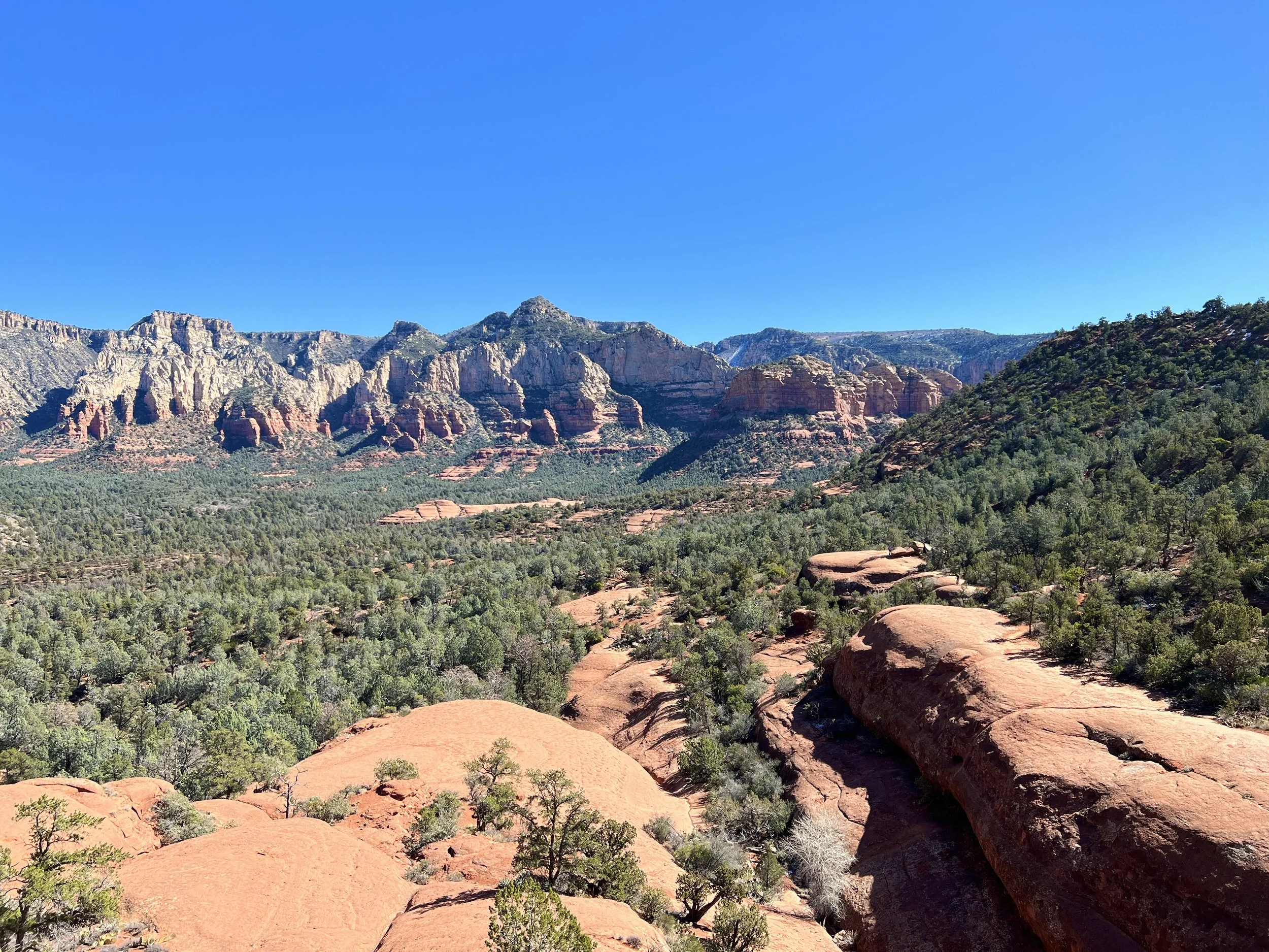
While you'll undoubtedly get a kick out of watching the riders try their luck on The Hogs' famous trails, the brief waves of bikers won't take away from the beauty of the area. As you hike along exposed slabs of red rock and scale short (but steep) stone staircases, you'll enjoy stunning views across Sedona and Oak Creek to the north, with the red rock formations rising dramatically in the distance. A few exposed rock cliffs offer fantastic spots to stop and have a snack and simply soak in the view. The Acropolis is visible in the distance just north of downtown Sedona, but Munds Mountain and Lee Mountain form the intimidating skyline to the east. From the eastern reaches of the loop, you'll also gain an elevated view of Submarine Rock—yet another popular stop on the Pink Jeep tours.
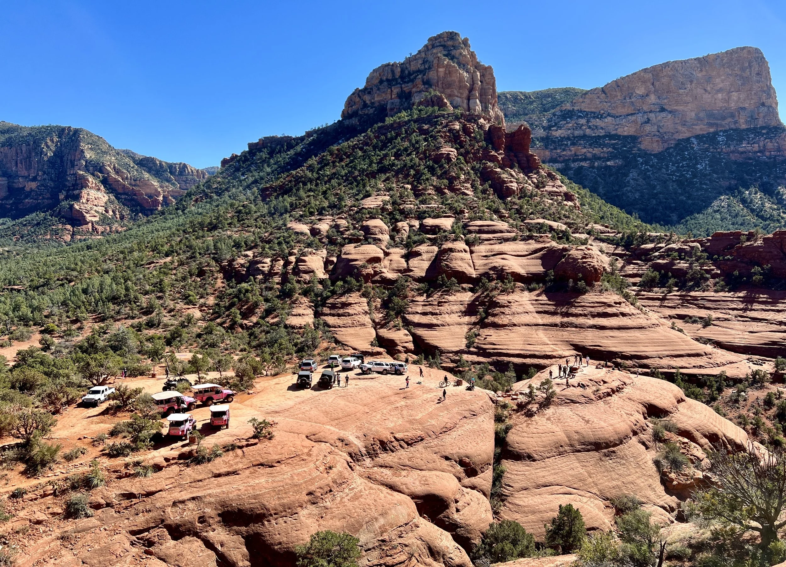
Chicken Point.
Eventually, you'll start to see more and more hikers as you approach Chicken Point, one of the most popular destinations served by the Pink Jeep Tours. While hordes of tourists inundate this beautiful viewpoint since you'll be on foot and spry of body, you have the choice to hike high up on the rock cliffs above Chicken Point (near the White Line trail) to enjoy the vista in relative solitude, without having to wade through the crowds. Once you've savored this stunning mountain pass through the red rock cliffs, you'll have to hike by the jeeps to head down the Little Horse trail to the Chapel Trail to complete your circuit of the mountain.
As you round the mountain and begin traversing the south side of the buttes, you'll note the soil, vegetation, and rock faces change ever due to the intensity of the sun. The views also transform, with a whole slew of other rock cliffs and views to enjoy as you switch to the opposite side of the mountain. Gibraltar Rock forms the opposite side of the pass at Chicken Point, and views into the distance reveal Courthouse Butte, Cathedral Rock, and more. On a loop hike such as this one, you get to enjoy a full 360-degree sensory experience that is guaranteed to keep you engaged (and pulling your camera out) the entire time!
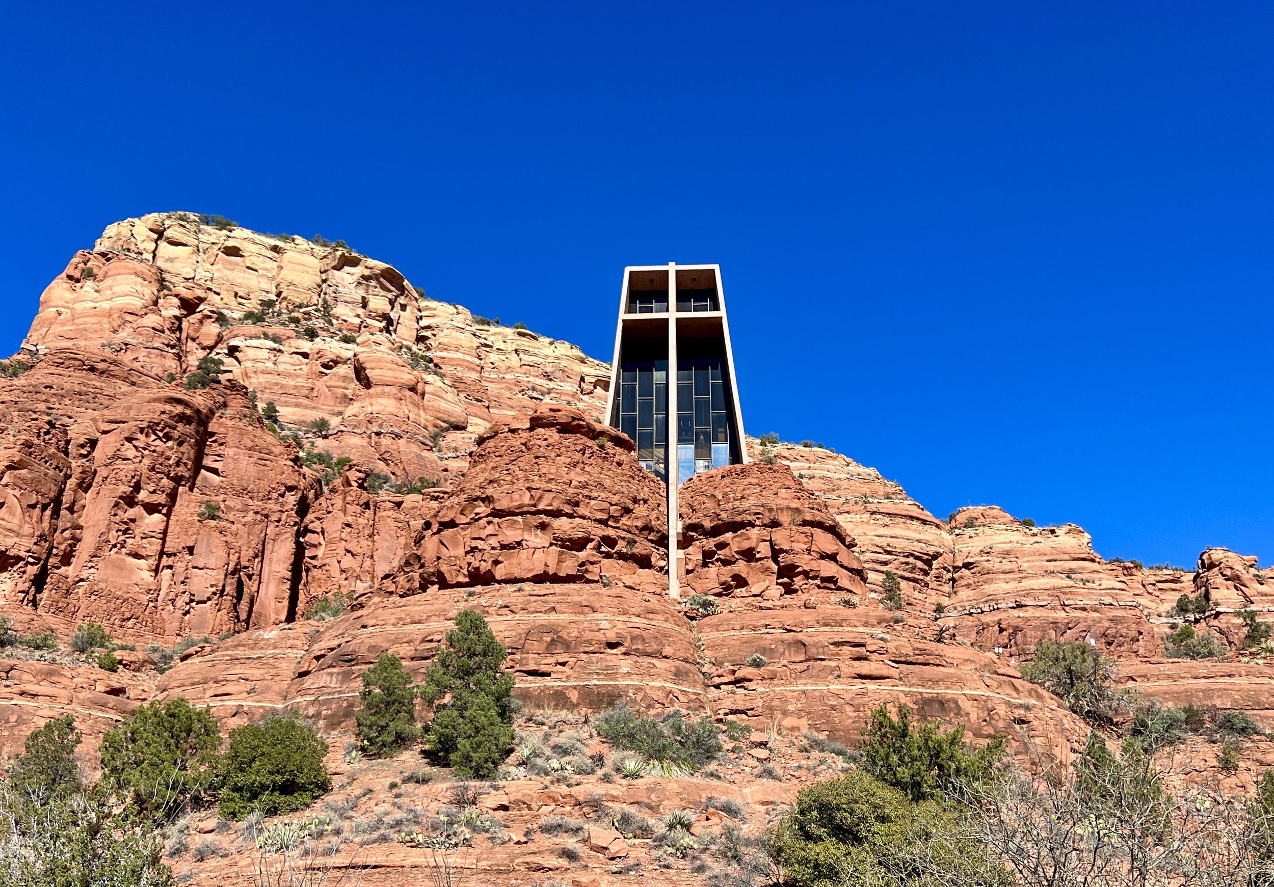
Upon reaching the Chapel, you can opt to hike up and check out this stunning structure. The Chapel was designed and built as an extension of nature—not to dominate or destroy nature, but to blend into the natural environment in which it's found. Or, you can choose to skip the crowds and just finish the circuit. Unfortunately, for the last 0.4 miles you'll have to walk along the busy paved road, but alas: there's no way around this. It's a small necessary evil for the fantastic loop hike that you've just experienced!