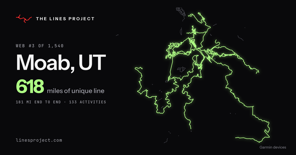
I’m stoked to announce that the Lines Project is finally open for registration! 🎉 After months of building this app in solitude, I can’t wait to release it to the world and share it with all of you. This has been a passion project in the true sense of the word, and I hope this new tool can help inspire you to explore the world.
(Too excited to read the rest? You can create your account right now at linesproject.com.)
The origin of the Lines Project
The Lines Project was born from my love of exploring the planet under my own power. For decades, I’ve been searching for new trails to ride and hike, the perfect powder stash, new roads to pedal, rivers to run, lakes to paddle, and so much more. I began marking my exploration by using a highlighter on a physical map, and eventually recording my adventures with a GPS unit. All of those GPS activities have combined to create a map full of recorded lines — hence, the Lines Project.

Naturally, as I’ve looked at my map full of lines, I began concocting ways to connect them together, to build webs of my own adventures, so that, in theory, I could travel from my front door to anywhere in a web without leaving my own lines. As I took this goal to the next level by trying to connect the lines from Canada to Mexico, I realized that there’s no real tool out there that could help me visualize my accomplishments and plan where to go next.
Sure, I’ve used a variety of the big software tools to help me along the way. Hell, I worked for FATMAP and subsequently Strava for 6 years. But no tool was perfect. And a few of my biggest questions — like how many unique miles I’ve explored and what my biggest interconnected web is — were impossible to answer.
During my time working for these mapping tech companies, I advocated hard for my visions of what we could build, but even at FATMAP, a small company of ~50, it was tough to influence the roadmap. And after moving to a company of 450? Forget about it.
But then, everything changed.
With the advent of AI, suddenly software development was democratized. Building software no longer requires years of technical training. Instead, with a willingness to learn and experiment, anyone with a clear vision of what they want to create can set out to make it happen. Now, that doesn’t mean it’s easy — I’ve spent months working on this app idea, and this is just the start of what I envision. But with AI coding tools, I’m no longer relegated to filing tickets and begging management to build the features I want. Instead, I can take the reins and turn my vision into reality.
So I’m doing exactly that.
What is the Lines Project?
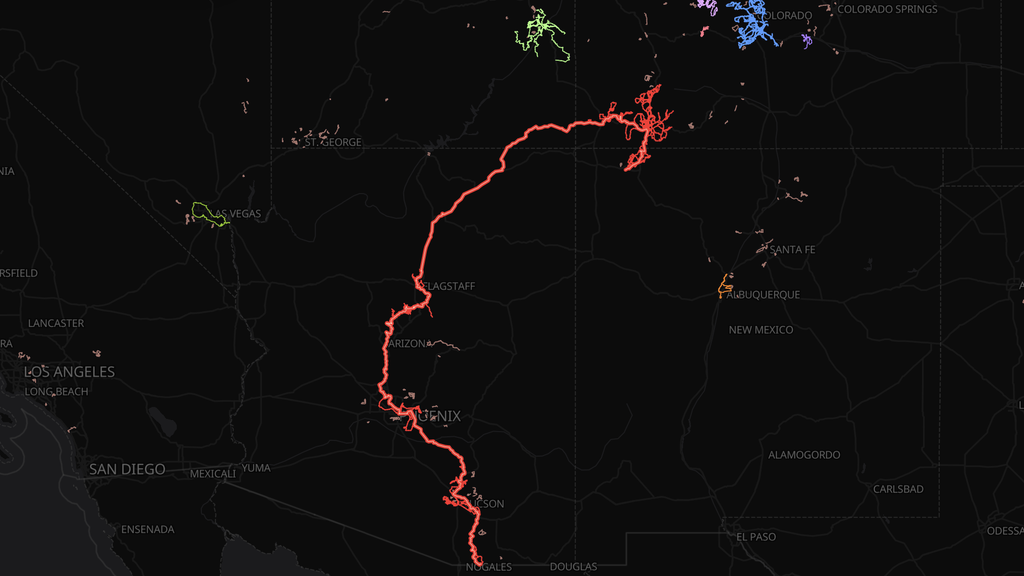
The Lines Project is that vision. This new app showcases everywhere you’ve ever explored on planet Earth. The headline number it gives you that no other app does (at least, accurately) is the total unique miles that you’ve explored.
Connect your accounts and it draws your activities as red lines on one map. Then it works out your unique miles, with each trail counted once no matter how many laps you’ve done on it. Lines that connect become webs, so you can see exactly how your riding fits together. And the beta testers’ favorite part: it finds the gaps between your webs, routes them for you, and tells you where to explore next.
It works with Strava, Ride with GPS, Suunto, Wahoo, Polar, COROS, and intervals.icu. You can also upload your files directly, including a full data export.
What sets it apart?
While most other products consider OpenStreetMap data as “the source of truth” for whether a trail or road exists, most mountain bikers know that OSM is woefully incomplete. I ride trails almost every week that don’t exist in OSM, and while I once attempted to add them all, I soon became overwhelmed by the immensity of the task.
Beyond that, when it comes to how many miles you’ve explored on the planet, who says that you have to be on a trail or road to explore? What about snow sports that don’t follow ski runs, water sports, or good old-fashioned off-trail hiking?
I quickly realized that comparing GPS files against OSM data is inherently a faulty way to figure out where you’ve been. And so, I built a proprietary analysis engine that calculates your unique mileage based on your GPS data alone.
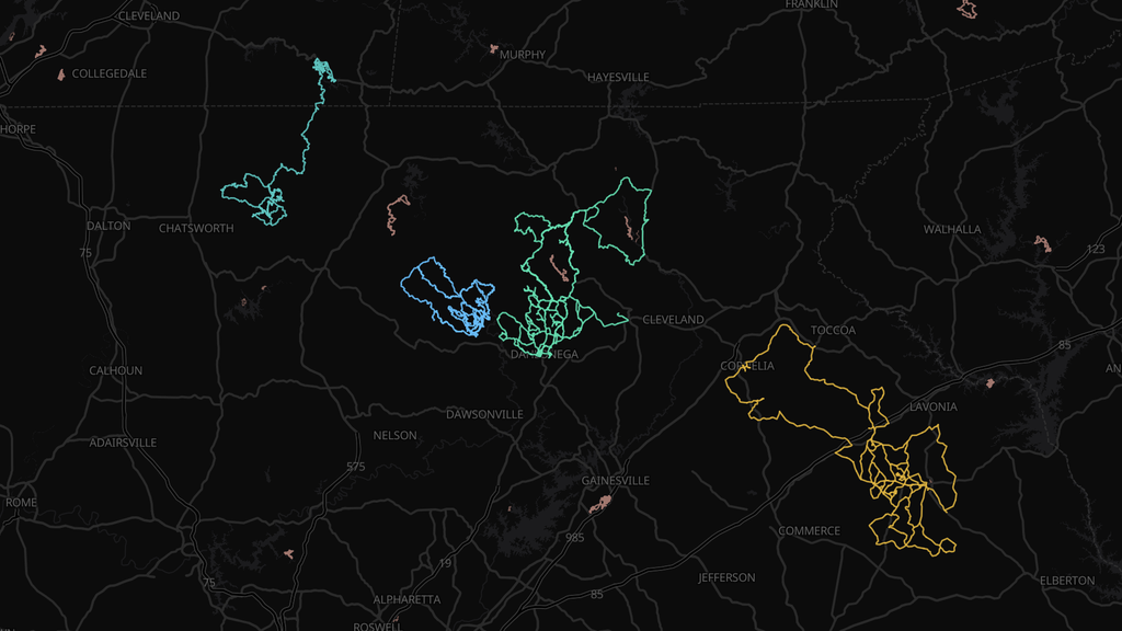
From this data, you can create some really interesting things. I’ve personally found the concept of webs, or connecting lines together, so motivating over the years, and now with the Lines Project, there’s a way to visualize it and see your webs expand as you continue to add to them.
And we’re just getting started…
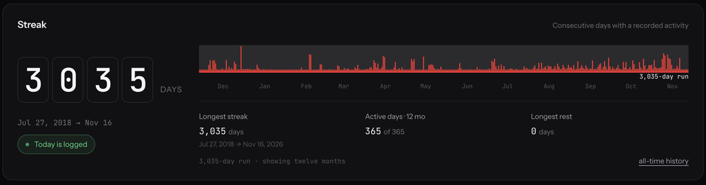
I’ve also built other features, including one that was built precisely for the Outside 365 audience: a daily streak tracker! And there’s much more to come: I have endless ideas for ways to visualize your exploration that go beyond just spreadsheets and tables filled with numbers.
The Lines Project makes your exploration visual, interactive, engaging, and motivating. I’d love for you to check it out and let me know what you think!
You can start free and see your 50 most recent activities on the map, no card needed. Or start a 7-day free Pro trial to draw your whole history — the clock doesn’t start ticking until your map is actually built. (A long history can take a while to import. Ask me how I know.)
And if you subscribe now, you’ll lock in our $30/yr starter price for life as one of our Founding Explorers.
See you out there,
Greg